CURRENT RESEARCH
Machine Learning based Algorithms and Software for Transportation and Smart Cities
Funded by NSF Cyber Physical Systems, NSF Smart Communities and Florida Department of Transportation

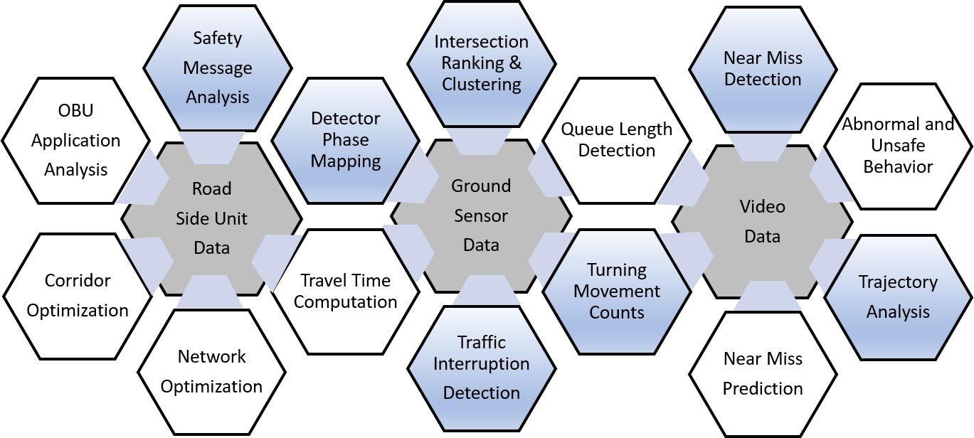
We are developing algorithms and software to fuse real-time feeds from video cameras and traffic sensor data to generate real-time detection, classification, and space-time trajectories of individual vehicles and pedestrians. This information is then transmitted to a cloud-based system and then synthesized to create a real-time city-wide traffic palette. Online and Offline processing, both at the edge and in the cloud, is then leveraged to achieve the following goals:
- Smart intersections: Space-time trajectories are used to understand and improve the safety and efficiency of the intersection. Using conflict points of the vehicle-pedestrian trajectories, we identify potential collisions, or “near-misses,” and how they are related to the state of the signal cycle (transition from green to yellow, from yellow to red, etc.) and the presence of other vehicles and pedestrians. The trajectories are then aggregated into demand profiles and turn movement counts by object type, which can be effectively used to determine signal timing for different hours of the day or days of the week.
- Smart streets: We are planning to equip the City of Gainesville’s transit buses with forward-facing cameras to continuously collect video data from streets and intersections. We expect this approach to provide very good coverage of the key roads, scalable to many cities. The video streams will then be processed on the bus and reduced to objects and trajectories which will be relayed to the cloud for storage and analysis. This will then ultimately be used for applications such as detection of pedestrians jaywalking – “mid-block crossing” – behaviors and how passengers approach or leave the transit buses at stops.
- Smart system: Abstracting a level further, the availability of space-time trajectories from several intersections and streets makes it possible to analyze a city’s transportation system holistically. For example, data from locations upstream of a crash location can be used to determine the possibility of traffic backups and secondary crashes. We are developing efficient signal re-timing for different corridors by time of day and day of the week to reflect the changes in network demand. We are also developing machine learning techniques for real-time detection of incidents and accidents on arterial networks.
- Smart interactions with connected and autonomous vehicles: We have developed signalized intersection control strategies and sensor fusion algorithms for jointly optimizing vehicle trajectories and signal control for a mixture of autonomous vehicles and traditional vehicles at every intersection. This approach uses short-range communication for autonomous vehicles and radar-based detection of traditional vehicles. These strategies are currently being field tested on actual signals at the Florida DoT’s TERL facility in Tallahassee and intersections in the City of Gainesville. Additionally, we are collecting data from interactions of vehicles with onboard units (that mimic the behavior of future connected vehicles) at 27 intersections in Gainesville with special roadside units.